-

by
Joe Lombardi
Weather
A major storm the National Weather Service is calling a "multi-hazard" is closing in on this region and the entire Northeast.A Winter Weather Advisory is in effect from Saturday at 4 p.m. until 10 a.m. Sunday for North Jersey and surrounding areas.Mixed precipitation is expected (see second image above) with a total accumulation of 2 to 4 inches of snowfall for most of the area.Ice ...
-

by
Joe Lombardi
Weather
A Winter Weather Advisory has been issued for much of the area as a wintry mix of snow, sleet and freezing rain will cause travel difficulties overnight into Tuesday morning.The advisory is in effect for 1 a.m. to 10 a.m. Tuesday, Jan. 8 in areas north of I-287 and the Merritt Parkway. (Areas in purple in the image above.)Plan on slippery road conditions overnight and early tomorrow ...
-

by
Daily Voice
Weather
A wet, raw day will bring a mixed bag of precipitation to the area Sunday through the overnight into Monday.Areas farther north will see a wintry mix of snow, sleet and freezing rain while southern areas will see rain. A look at the dividing line between rain (green) and a wintry mix (pink) appears in the first image above.North of I-84, precipitation will transition to mainly snow this ...
-

by
Daily Voice
Weather
The National Weather Service is warning residents throughout the Hudson Valley and Fairfield County that a brief period of freezing rain is possible overnight in areas farther south while accumulating ice and snowfall is expected north of I-84 into early Monday morning.A Winter Weather Advisory has been issued for parts of the area. The advisory is in effect from midnight Sunday, Dec. ...
-
by
Joe Lombardi
Weather
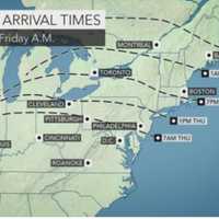
Click here for an updated story: Projected Accumulations For Nor'easter Increase Again; Gusty Winds Could Cause Power OutagesA Nor'easter roaring into the area Thursday afternoon will bring a mix of rain, sleet and the first accumulating snowfall of the season in a rare pre-Thanksgiving winter storm.School districts throughout the area have been announcing early dismissals during the ...
-
by
Joe Lombardi
Weather
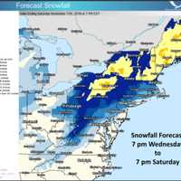
Click here for an updated story: Storm Watch - Here's Latest As Nor'easter Takes Aim On Area, Schools Announce Early Dismissals A Nor'easter sweeping its way from the south will barrel through Washington, D.C., and Philadelphia before roaring into the area Thursday afternoon as new snowfall projections for the storm show a slight increase in accumulation.Southern parts of Westchester, ...
-

by
Joe Lombardi
Weather
Brand-new projected snowfall totals for the storm that will sweep through the area overnight into Monday were released early Sunday evening by the National Weather Service.The quick-moving storm system could now bring up to 5 inches of snowfall to most of the area. Snowfall rates of around one inch per hour are possible Monday morning.And that's no April Fool's Day joke.But it is ...
-

by
Joe Lombardi
Weather
Click here for an updated story: Latest Snowfall Totals Released For Storm That Will Sweep Through AreaIt looks like Old Man Winter didn't get the memo that the calendar has turned from March to April.The start of the first workweek of the month will be ushered in by a quick-moving storm system that is now expected to bring 3 to 4 inches of snowfall to most of the area. Snowfall rates ...
-

by
Zak Failla
Breaking News
The latest batch of winter weather has left roadways treacherous for drivers, as Connecticut State Police troopers continue making the rounds, responding to multiple crashes and spin-outs, most of which occurred during the morning commute.Connecticut State Police troopers were all over the place on Tuesday morning, responding to 27 crashes with minor or no injuries, and assisting 64 ...
-

by
Joe Lombardi
Weather
The third Nor'easter to hit the area in a 10-day span arrived overnight and picked up in intensity through the morning commute with bands of heavy snow that quickly created travel difficulties.Snowfall at rates of an inch or more an hour will continue to be possible through late morning. Snowfall accumulations in the tristate area will range from 3 to 8 inches. (See latest projections ...
-
by
Joe Lombardi
Weather
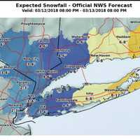
Click here for an updated story: Nor'easter Brings Heavy Snow, WindAs the third Nor'easter in two weeks moves into the area overnight, new snowfall projections were released by the National Weather Service late Monday afternoon.Most of the tristate area is expected to see 3-4 inches of accumulation, with a range of 4 to 6 inches in the eastern sections of Westchester, Putnam and ...
-
by
Joe Lombardi
Weather
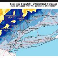
As a powerful Nor'easter takes aim on the region, the latest projections show higher than previously expected snowfall totals for areas farther.Here's a rundown of what to expect by county.Westchester, Rockland, Southern Fairfield:Wind Advisory from 11 a.m. Friday to 6 a.m. Saturday, Flood Watch from 6 a.m. Friday to 6 a.m. Saturday. Rain before 2 p.m. Friday, then rain and snow with a ...


